Blog
The Ultimate Garmin GPS Guide
1. Introduction
Garmin GPS is a global leader in GPS technology, providing a wide range of products tailored for various industries, including aviation, marine navigation, automotive, sports, and outdoor adventures. Whether you’re a pilot needing accurate flight data, a boater looking for advanced sonar and radar systems, or a motorcyclist seeking reliable GPS navigation, Garmin has a product designed to meet your needs.
As GPS technology continues to evolve, Garmin has kept up with innovations, integrating cutting-edge features such as satellite messaging, real-time traffic updates, fitness tracking, and marine sonar imaging. From handheld GPS devices for hikers to sophisticated aviation systems used by pilots, Garmin offers an impressive range of products that cater to different user preferences and requirements.
This article aims to provide a comprehensive comparison of Garmin devices, their features, advantages, and limitations. Additionally, we will discuss troubleshooting tips, connectivity options, and must-have accessories to help you make the most of your Garmin device.
Suppose you’re unsure about which Garmin device suits your needs. In that case, this guide will provide in-depth information on various models, their functionalities, and how they stack up against competitors like Simrad, ForeFlight, and Paddlenav.
2. Garmin Device Comparisons

When choosing a Garmin device, it’s essential to consider factors such as battery life, GPS accuracy, durability, software compatibility, and additional features like satellite messaging and mapping options. This section provides a detailed comparison of popular Garmin devices and their alternatives to help you decide which one fits your specific needs.
2.1 Garmin 62s vs 67i: Which One Should You Choose?
Garmin’s handheld GPS devices are popular among hikers, campers, and outdoor enthusiasts. The Garmin 62s and Garmin 67i are two well-known models in this category, each offering unique advantages.
Garmin 62s: Features and Benefits
- A reliable handheld GPS designed for outdoor activities such as hiking, geocaching, and trekking.
- Features preloaded TOPO maps, a barometric altimeter for elevation tracking, and GPS/GLONASS support for accurate location tracking.
- Long-lasting battery life, providing up to 20 hours of continuous usage.
- Durable and waterproof, making it suitable for harsh weather conditions.
Garmin 67i: Features and Benefits
- A newer version of Garmin’s handheld GPS lineup, featuring inReach satellite communication for messaging and emergency SOS.
- Supports multi-band GPS and Galileo for enhanced accuracy.
- Extended battery life, lasting up to 165 hours in standard GPS mode and 1800 hours in expedition mode.
- Offers TopoActive maps with detailed terrain insights, making it ideal for backcountry navigation.
Key Differences
| Feature | Garmin 62s | Garmin 67i |
| Satellite Communication | No | Yes (inReach) |
| Battery Life | Up to 20 hours | Up to 165 hours (GPS mode) |
| Mapping | Preloaded TOPO maps | TopoActive maps with satellite imagery |
| Multi-Band GPS | No | Yes (GPS, Galileo) |
Verdict: If you require basic navigation with a durable GPS unit, the Garmin 62s is a great choice. However, if you need satellite communication and better battery life, the Garmin 67i is the superior option, especially for remote and off-grid adventures.
2.2 Garmin 62s vs 67s: Key Differences and Similarities
The Garmin 67s is another upgrade in the 60-series lineup, closely resembling the 67i but without inReach messaging capabilities.
Comparison Between 62s and 67s
- Both models are handheld GPS units with rugged designs and outdoor durability.
- Battery life is a major difference: the 67s lasts significantly longer than the 62s, making it ideal for multi-day trips.
- The 67s has improved GPS tracking, offering better accuracy due to multi-band GNSS support.
- If you don’t need satellite messaging but still want longer battery life and more precise navigation, the Garmin 67s is the better option.
2.3 Simrad vs Garmin: Which Navigation System is Better?
For marine enthusiasts, Simrad and Garmin are two of the most recognized names in the industry. Both brands offer advanced chart plotters, fish finders, and radar systems, but their strengths differ.
Simrad: Strengths and Features
- Excellent for professional mariners and fishermen, providing high-quality sonar imaging and radar detection.
- Offers dedicated offshore and commercial-grade features.
- Highly customizable with add-ons like autopilot systems and multi-display integrations.
Garmin: Strengths and Features
- User-friendly interface designed for recreational boaters and anglers.
- Provides detailed BlueChart marine maps with quick route planning and GPS guidance.
- Supports LiveScope sonar imaging, offering real-time underwater visuals.
Verdict: If you need highly advanced marine technology for professional use, Simrad is a strong choice. However, for recreational boating, Garmin’s ease of use, affordability, and advanced sonar technology make it a preferred option.
2.4 Garmin Pilot vs ForeFlight: Best Flight Navigation Software?
Both Garmin Pilot and ForeFlight are widely used aviation apps for flight planning, GPS navigation, and weather updates.
| Feature | Garmin Pilot | ForeFlight |
| Integration | Best with Garmin avionics | Works with multiple systems |
| Mapping & Navigation | High-resolution Garmin maps | Jeppesen charts support |
| Weather Radar | ADS-B weather updates | Global weather coverage |
| Traffic Awareness | Real-time ADS-B traffic alerts | Advanced traffic insights |
| Best For | Garmin avionics users | Commercial and GA pilots |
Verdict:
- Garmin Pilot is the better option for those who already use Garmin avionics, as it seamlessly integrates with their systems.
- ForeFlight is ideal for commercial pilots and flight schools due to its Jeppesen chart support and global aviation coverage.
Garmin Pilot: Features
- Designed by Garmin, seamlessly integrating with Garmin avionics and GPS devices.
- Offers ADS-B traffic display for enhanced situational awareness.
- Provides real-time weather updates and route planning.
ForeFlight: Features
- Widely used in commercial and general aviation, known for its user-friendly interface.
- Supports Jeppesen charts, making it a preferred choice for professional pilots.
- Offers synthetic vision for enhanced cockpit awareness.
Verdict: If you are already using Garmin avionics, Garmin Pilot is the best option. However, ForeFlight’s extensive features and compatibility with Jeppesen charts make it a top choice for professional pilots.
2.5 Paddlenav vs Garmin BWCA: Which One Works Best for Paddling?
For canoeists and kayakers exploring the Boundary Waters Canoe Area (BWCA), navigation tools are essential.
Paddlenav: Features
- A navigation tool specifically designed for paddlers, offering detailed maps of canoe routes, portages, and campsites.
Garmin BWCA: Features
- Garmin’s GPS systems allow paddlers to navigate off-grid with detailed waterway maps and waypoints.
- Works without internet access, providing reliable tracking in remote areas.
Verdict: If you need a specialized tool for paddling, Paddlenav may be the better option. However, for general GPS tracking and offline mapping, Garmin’s handheld GPS units are superior.
Conclusion for Device Comparisons
Garmin offers a variety of GPS devices, each tailored for different applications. Whether you need a rugged handheld GPS for hiking, a marine radar system, or flight navigation software, Garmin has a product that fits your needs. By comparing these devices, you can make an informed decision based on features, pricing, and compatibility with your specific activities.
Garmin Aviation Products and Troubleshooting & Garmin Radar and Marine Accessories – In-Depth Guide
Garmin is a leading name in aviation and marine technology, offering top-tier products that enhance navigation, communication, and radar functionality. Whether you’re an aviator seeking precision in flight systems or a mariner looking for reliable radar and sonar solutions, Garmin’s cutting-edge devices and accessories are built to ensure accuracy, safety, and efficiency.
This section will explore:
- Garmin aviation products, their features, and how they enhance flight navigation.
- Common Garmin aviation issues and troubleshooting techniques.
- Garmin radar systems and the necessary accessories for optimal performance.
- Choosing the right cables and mounts for Garmin’s radar systems.
3. Garmin Aviation Products and Troubleshooting
Garmin aviation products provide advanced navigation, communication, and avionics solutions to both commercial and private pilots. Understanding these systems can help optimize their use and troubleshoot common issues effectively.
3.1 What’s PMA in Garmin Aviation?
The term PMA (Parts Manufacturer Approval) in Garmin aviation refers to a certification issued by the FAA (Federal Aviation Administration) for aircraft parts. This ensures that components meet stringent safety and performance standards.
Why Is PMA Important?
- FAA-Approved: PMA-certified Garmin components meet aviation safety regulations.
- Cost-Effective: These parts can often be cheaper than OEM components, offering a reliable alternative.
- Guaranteed Compatibility: PMA-certified Garmin parts are designed to work seamlessly with approved aircraft models.
Which Garmin Products Have PMA?
- Garmin avionics systems, GPS units, and transponders often come with PMA approval.
- Components like autopilot systems and navigation displays are PMA-certified for commercial aircraft.
If you’re installing a Garmin system in an aircraft, checking for PMA certification ensures compliance with aviation safety standards.
3.2 Garmin SL 30 Flat Pack NAV/COM: Features and Benefits
The Garmin SL 30 Flat Pack NAV/COM is a compact, high-performance communication and navigation system used in general aviation.
Key Features:
- Dual-frequency monitoring – Listen to two communication channels simultaneously.
- High-resolution LCD display – Ensures clear readability in all lighting conditions.
- Compact flat-pack design – Ideal for aircraft with limited panel space.
- Built-in VOR receiver – Provides accurate navigation information.
Benefits:
- Reduces workload for pilots with real-time monitoring.
- Space-saving design allows for easy installation in any cockpit.
- Reliable performance makes it a trusted choice for private and commercial pilots.
The SL 30 Flat Pack NAV/COM is perfect for pilots who need an all-in-one communication and navigation solution in a small yet powerful package.
3.3 Garmin 175 Converted: How to Upgrade Your System
The Garmin 175 GPS navigator can be converted and upgraded to include additional capabilities such as WAAS (Wide Area Augmentation System) support for better GPS accuracy.
Why Upgrade to a Converted Garmin 175?
- Enhances GPS accuracy with WAAS support.
- Improves flight planning and routing with updated software.
- Increases compatibility with modern avionics systems.
Upgrade Process:
- Check your current Garmin 175 model – Ensure compatibility with conversion kits.
- Install updated firmware and software to enable new features.
- Verify WAAS functionality for improved navigation performance.
- Perform a system test before your next flight to confirm successful conversion.
If you’re looking to modernize your Garmin 175, converting it is an affordable way to boost its capabilities without buying a brand-new system.
3.4 STEC-65 and Garmin 500: Compatibility and Setup
The STEC-65 autopilot system is commonly used with the Garmin G500 primary flight display for enhanced flight control and stability.
Setting Up the STEC-65 with Garmin 500:
- Ensure firmware compatibility between the STEC-65 and Garmin 500.
- Perform a calibration check to align the autopilot with the flight display.
- Adjust sensitivity settings for smoother flight stabilization.
Common Issues & Solutions:
- Autopilot instability → Recalibrate and adjust servo settings.
- Unresponsive controls → Update firmware and check wiring connections.
- Navigation errors → Ensure proper GPS signal reception.
A properly configured STEC-65 with a Garmin 500 offers a more stable and automated flight experience.
3.5 Garmin Aviation Database Manager Unrecoverable Error: How to Fix It?
Pilots updating their Garmin Aviation Database may encounter an unrecoverable error when using the Garmin Aviation Database Manager.
Troubleshooting Steps:
- Restart the database manager and check for software updates.
- Ensure administrator privileges when running the application.
- Delete corrupt database files and reinstall the latest version.
- Check internet connection for stable downloads.
If the issue persists, contact Garmin support for assistance in manually updating your aviation database.
4. Garmin Radar and Marine Accessories
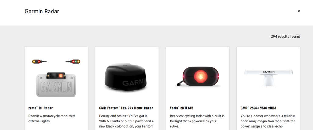
Garmin offers advanced radar and marine accessories that provide accurate navigation, weather tracking, and marine safety features.
4.1 Cables for GMR18 Garmin Radar System: Installation and Maintenance
The Garmin GMR18 Radar System requires specific cables for installation and power delivery.
Key Cable Types:
- Power cables – Deliver energy to the radar unit.
- Data cables – Transmit radar signals to the display.
- Adapter cables – Convert older connections to newer Garmin interfaces.
Installation Tips:
- Use Garmin-certified cables to ensure signal integrity and power efficiency.
- Secure connections to prevent water damage in marine environments.
- Regularly inspect cables for wear and tear to avoid connectivity issues.
4.2 Garmin GMR 18 Radar Cables: Essential Guide
The Garmin GMR 18 is a powerful marine radar, and using the correct cables is crucial for optimal performance.
Choosing the Right Cables:
- Data transmission cables → Ensure a stable connection to Garmin chartplotters.
- Power cables → Must support high-wattage requirements for continuous operation.
Regular maintenance of Garmin GMR 18 cables helps extend their lifespan and prevent connectivity problems.
4.3 Cables for 18 Garmin Radar System: Which One Do You Need?
The 18 Garmin Radar System requires a combination of power, data, and network cables for full functionality.
Essential Cable Types:
- Garmin Marine Network Cables – Connect radar to MFDs.
- Power Supply Cables – Ensure uninterrupted operation.
To avoid signal loss or radar malfunctions, always use Garmin-approved cables.
4.4 Trolling Motor Mount for Garmin GT56 Transducer: Best Setup Tips
The Garmin GT56 Transducer provides high-resolution sonar imaging, and a proper trolling motor mount ensures the best results.
Mounting Tips:
- Attach the mount securely to prevent vibrations.
- Position the transducer properly for optimal sonar clarity.
- Use marine-grade fasteners to secure the mount.
Installing a trolling motor mount for the Garmin GT56 transducer enhances fishing accuracy and underwater navigation.
Garmin Automotive, Sports, and Connectivity Solutions – A Detailed Guide
Garmin offers a wide range of accessories and devices for automotive, motorcycle, sports, and outdoor activities. Whether you’re looking for navigation systems for your car, power solutions for your motorcycle GPS, or connectivity adapters for seamless integration, Garmin has you covered.
This section will explore:
- Essential Garmin automotive and motorcycle accessories for enhanced navigation and convenience.
- Sports and outdoor solutions that improve battery performance and location tracking.
- Garmin adapters and connectivity options for integrating multiple Garmin devices.
5. Garmin Automotive and Motorcycle Accessories

Garmin’s automotive and motorcycle accessories are designed to enhance the driving and riding experience by providing reliable navigation, mounting solutions, and power management.
5.1 Garmin SmartDrive 76 Zubehör: Must-Have Accessories
The Garmin SmartDrive 76 is a powerful GPS navigation system for drivers, offering a 7-inch display, real-time traffic updates, and voice control. To get the best experience, certain accessories (Zubehör in German) are must-haves.
Top Accessories for the Garmin SmartDrive 76:
- Car Mounts → Secure the GPS unit on the dashboard or windshield for easy viewing.
- Charging Cables → Keep the device powered with Garmin-certified power cables.
- Carrying Cases → Protect the GPS unit from scratches and damage when not in use.
- Traffic Receiver → Enhances real-time traffic updates for better route planning.
Investing in the right Garmin SmartDrive 76 Zubehör ensures a smooth and efficient driving experience.
5.2 Garmin Zumo XT USB Power for Motorcycles: Installation Guide
The Garmin Zumo XT is a rugged motorcycle GPS that requires a reliable USB power connection for uninterrupted performance.
Steps to Install USB Power for Garmin Zumo XT:
- Locate a Power Source:
- Use the motorcycle’s battery or accessory power port.
- Connect the USB Power Cable:
- Use Garmin’s dedicated USB power cable to ensure proper voltage regulation.
- Secure the Cable Routing:
- Avoid areas with high heat or moving parts to prevent damage.
- Test the Connection:
- Ensure the Garmin Zumo XT powers on and charges correctly.
With a properly installed USB power connection, riders can enjoy long-distance navigation without worrying about battery depletion.
5.3 Phone Pixel Garmin Edge Mount: Best Mounting Solutions
For cyclists using a Google Pixel phone and a Garmin Edge GPS device, a mounting solution is essential for keeping both devices secure and accessible.
Best Mounting Options:
- Universal Phone & Garmin Mounts → Allows side-by-side placement of Pixel phones and Garmin Edge GPS units.
- Handlebar Mounts → Attach the Garmin Edge and phone securely to the handlebars for easy navigation.
- Quick-Release Mounts → Enable fast removal and attachment of the devices.
Using a high-quality mount ensures safe and convenient access to both the Pixel phone and Garmin Edge during cycling trips.
6. Garmin Sports and Outdoor Equipment

Garmin’s sports and outdoor devices help athletes, outdoor enthusiasts, and professionals navigate terrains, track performance, and optimize battery usage.
6.1 Garmin Soccer Complex Map: Navigating the Fields
The Garmin Soccer Complex Map is a detailed navigation tool designed for soccer players, coaches, and event organizers.
Features and Benefits:
- Detailed Field Layouts → Helps players and coaches find specific field locations.
- Integrated Navigation → Works with Garmin devices and smartphones for easy route planning.
- Weather and Traffic Updates → Provides real-time alerts to help teams arrive on time.
By using the Garmin Soccer Complex Map, athletes can quickly navigate large soccer complexes and focus on their game.
6.2 Garmin Battery Recommendations for Panoptix Livescope: How to Extend Battery Life
The Garmin Panoptix LiveScope is a high-tech sonar system used for fishing, but battery life is a common concern.
Recommended Batteries for Panoptix LiveScope:
- Lithium-Ion Batteries → Last longer than standard lead-acid batteries.
- High-Capacity 12V Batteries → Ensure extended usage during fishing trips.
Battery Optimization Tips:
- Lower Screen Brightness → Reduces power consumption.
- Use Energy-Efficient Modes → Garmin devices offer battery-saving settings.
- Charge Before Each Trip → Prevents mid-session battery failure.
With proper battery management, anglers can maximize their time on the water with Panoptix LiveScope.
7. Garmin Adapters and Connectivity
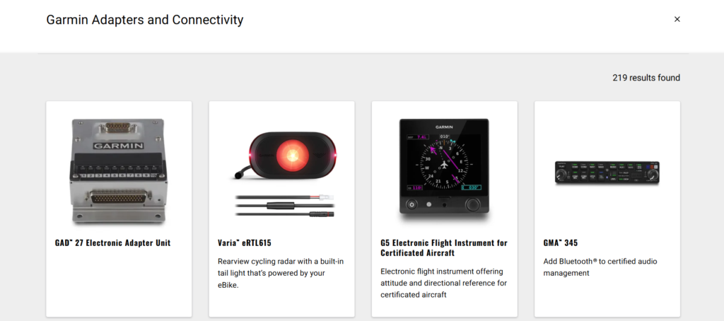
Garmin offers a range of adapters and connectivity solutions to ensure seamless integration between different devices.
7.1 Garmin 4-Pin to 8-Pin Adapter: When and How to Use It
Garmin devices use different pin configurations, making the Garmin 4-pin to 8-pin adapter essential for connecting incompatible devices.
When Do You Need This Adapter?
- If you’re upgrading from an older Garmin device with a 4-pin connector to a newer 8-pin model.
- If you want to connect Garmin transducers to different sonar or GPS units.
How to Use the Garmin 4-Pin to 8-Pin Adapter:
- Plug the 4-pin connector into the older Garmin device.
- Attach the 8-pin end to the newer Garmin unit.
- Ensure a tight connection for uninterrupted data transmission.
This adapter helps extend the lifespan of older Garmin equipment by allowing them to work with newer Garmin systems.
7.2 Can You Connect the Garmin R10 to Foresight?
The Garmin Approach R10 is a portable launch monitor used by golfers, and many wonder if it can connect to Foresight software.
Compatibility Details:
- The Garmin R10 is not natively compatible with Foresight Sports GCQuad or GC3 software.
- However, golfers can use third-party apps and integrations to view shot data from both systems.
Alternative Solutions:
- Use the Garmin Golf App for detailed shot analytics.
- Explore third-party integrations to sync Garmin R10 data with Foresight.
While direct compatibility is limited, there are alternative ways to use the Garmin R10 alongside Foresight for golf performance tracking.
Conclusion
Garmin has established itself as a leader in navigation, outdoor adventure, aviation, and sports technology. Whether you need automotive GPS units, motorcycle power accessories, aviation navigation systems, marine radar solutions, or sports tracking devices, Garmin provides cutting-edge technology designed for reliability and performance.
In this article, we explored various Garmin products, from the SmartDrive 76 GPS and Zumo XT motorcycle power system to aviation navigation tools like the SL 30 and 175 Converted, as well as sports technology like the Garmin Panoptix Livescope and the R10 launch monitor. We also delved into connectivity solutions like the Garmin 4-pin to 8-pin adapter and marine radar cables, ensuring that Garmin users can maximize their device compatibility and performance.
By understanding the best accessories, troubleshooting common issues, and optimizing device settings, Garmin users can enhance their overall experience, whether on the road, in the air, on the water, or on the golf course. Investing in the right Garmin accessories can significantly improve usability, extend device lifespan, and offer a more seamless navigation and tracking experience.
As Garmin continues to innovate and improve its technology across different industries, users can expect even more advanced features, better connectivity, and improved battery efficiency in future products.
If you’re considering upgrading or optimizing your Garmin setup, make sure to choose the right accessories and troubleshooting solutions to get the most out of your investment. 🚀
Frequently Asked Questions (FAQs)

1. Can I connect the Garmin R10 to Foresight software?
No, the Garmin Approach R10 does not natively connect to Foresight Sports software like GCQuad or GC3. However, some third-party applications may allow data transfer between these systems.
2. What’s the difference between the Garmin 62s and the 67i?
The Garmin 67i is an upgrade to the 62s, featuring enhanced satellite communication, better battery life, and inReach® technology for emergency messaging, which the 62s lacks.
3. How do I fix the Garmin Aviation Database Manager Unrecoverable Error?
To fix this error:
- Ensure you have the latest Garmin software updates installed.
- Restart the Garmin database manager and check for corrupt files.
- If the issue persists, reinstall the database manager or contact Garmin support.
4. What’s PMA in Garmin aviation?
PMA (Parts Manufacturer Approval) refers to FAA-certified replacement parts for Garmin aviation products. These parts meet strict safety and performance regulations required for aviation use.
5. Which cables do I need for the Garmin GMR18 radar system?
You will need:
- Garmin GMR 18 power and data cables
- Ethernet cables for radar networking
- Mounting brackets and connectors for secure installation
6. How do I install USB power for the Garmin Zumo XT on a motorcycle?
To install USB power:
- Connect the Garmin USB power cable to your motorcycle’s battery or power port.
- Secure the wiring alongside the motorcycle frame to prevent tangling.
- Test the power connection before mounting the GPS device.
7. Is the Garmin SmartDrive 76 good for long road trips?
Yes! The Garmin SmartDrive 76 is ideal for long road trips, thanks to its 7-inch screen, real-time traffic updates, voice navigation, and hands-free calling. It ensures a smooth and stress-free driving experience.
8. How do I extend the battery life of my Garmin Panoptix Livescope?
To extend battery life:
- Use high-capacity lithium-ion batteries instead of standard lead-acid batteries.
- Lower the screen brightness on your Garmin display.
- Enable battery-saving settings in the device menu.
9. Can I use a trolling motor mount for the Garmin GT56 transducer?
Yes, the Garmin GT56 transducer can be mounted on a trolling motor using Garmin’s dedicated trolling motor mount kit. This setup provides better sonar coverage and stability.
10. What are the benefits of the Garmin SL 30 Flat Pack NAV/COM?
The Garmin SL 30 NAV/COM is a compact aviation radio system offering:
- Dual NAV/COM capability for pilots.
- Easy frequency switching with a standby monitoring feature.
- Lightweight, space-saving design ideal for aircraft dashboards.
By understanding the best Garmin accessories, troubleshooting solutions, and connectivity options, users can enhance their experience and make the most out of their Garmin devices.
Explore more by joining us on IqBirds